Showing posts with label Lenabo. Show all posts

Monday, 11 October 2010

RNAS Lenabo

The connection between airships and the Formartine Buchan Way may not immediately be apparent but during WW1 there was a direct rail link from Longside Station to RNAS Lenabo, the most northerly of Britain's airship bases. (This is not to be confused with Longside Airfield) The remains of the airship station are extraordinary and worth a digression.
Memorial constructed from the remains of what is thought to have been the Officers' Mess at Lenabo


Lenabo Airship Station (RNAS Longside) was built in 1915 on a vast peat bog in order to provide allied shipping additional protection from German U boats operating in the North Sea. Lenabo consisted of 3 large airship sheds each 100 ft high, each protected by immense windbreak walls. In order to transport materials and personnel efficiently to the site a railway spur was constructed from Longside Station to the base. Over 32, 000 tons of  materials and stores were carried by train to Lenabo. The line was used exclusively for the base, ceased to operate in 1920 and existed only until 1923 when the trackway was removed. A small town consisting of support services, water tanks, gasworks, gasometers, barracks, canteens, a church and a theatre was rapidly constructed on the bog. Some of the peat extracted from the site was used to power the steam scoops, steam lorries, bucket cranes and locomotives used in constructing the site. Around 500 naval personnel were deployed on the site. The effectiveness of the airships is very much open to question and interest in airships generally waned after the war ended. The site was decommissioned in 1920, the buildings were flattened  but the concrete bases and larger chunks of concrete masonry remain mysteriously in what is now an extensive mature woodland.On November 11th 1918 it was a dispatch rider from Lenabo who took official news of the signing of the Armistice to the Peterhead Sentinel.


Following the route of one of the original roads a track from the main gate leads straight ahead to the hangars


The vast concrete floor of one of the airship hangars

The concrete panels which made up the enormous windbreaks remain, like collapsed dominoes, amongst the trees


Huge concrete mooring blocks were used to anchor the airships. The airships were called 'Lenabo soos' by the local farmers. Landing the airships involved everyone on the base,  including the station dog who was trained to assist by grabbing the end of the landing cable which, when thrown from the airship, inevitably landed in a tangled heap. The cable was then passed through an iron ring on a vast concrete block to prevent the airship from rising again.
Normally 100 naval ratings were needed then to manoeuvre the airships in to the sheds by hauling on the landing cable. It was almost impossible to handle the ships in bad weather. Each ship had an emergency panel which could be activated to deliberately  rip the casing causing the gas to escape and the ship to collapse. On 21st September 1918 two coastal airships landed in  a gale, even with 400 men on the ropes it was impossible to get the airships into the sheds in such  a strong wind and they had to be deliberately ripped.

 
On the right of the main gate a track, following the course of one of the original site roads, runs parallel to the main  road and leads to the remains of barracks, the gasworks, coal bunkers (pictured above) and water culverts.


Two of the many covered water culverts which led water  to - or from a large water storage tank related to the gasworks.


Sunday, 29 August 2010

Mintlaw to Longside


The 2.5 mile stretch of line from the main Fraserburgh Mintlaw (A952) road to Longside forms a pleasant but not particularly interesting walk. Unfortunately, the tranquility of the walk  is spoilt by the noise of traffic from the Longside Peterhead (A950) road which follows the Line closely along the valley of the South Ugie Water. 

There are several distance posts along the first part of the line.


The woods contain an interesting mix of trees. These include rowan, elder, ash, snowberry, guelder rose, dog wood, hawthorn, silver birch, cherry and the occasional conifer. There is a great sprawling tangle of roses which it is not possible to identify at present.


Guelder rose


An incredibly contorted hawthorn growing close to the crossing with the minor road to Moss of Longmuir
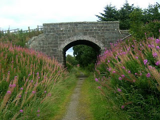


Bridge 718, close to a disused quarry, now a sawmill, retains remains of telegraph wires. This was the first railway line to be opened with telegraph wires along its entire length.


'The Howes o Buchan' refers to a distillery, Glen Ugie,  in this area which had recently (1865) been converted in to a sawmill, but gives the position as being on the left of the line going towards Mintlaw

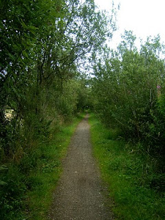
Approaching Longside the track runs through uncultivated fields which look damp and were referred to in 'The Howe o'Buchan' as being  probably liable to flood. Here the line is on an embankment along which willows form a leafy tunnel. At the end of the willow tunnel there is a tangled bank which includes  patches of great mullein.


First view of Longside from the Line, looking across the Ugie. Beyond the tree is  the start of the 'flood plain' area


Just before Longside Station the walkway has a short diversion to enable the main road to be crossed. The steps which facilitate this are made of pink granite slabs and clearly show drill marks. This is close to Auchlee Bridge. Longside Golf Course is on the opposite bank of the river.

Beyond the bridge there is a steep embankment on the side of track furthest from the river, this is currently covered in greater bindweed and brambles. There are allotments between the track and the golf course. The station is very disappointing. Only the two overgrown platforms remain festooned in ivy leaved toadflax.


Fox and Cubs or  Orange hawkweed (Hieracium aurantiacum) brightens up the bed of the line in the station
The station platform looking towards Peterhead. The branch line to RNAS Lenabo (operational from1914-1919) ran roughly South for 3miles from slightly East of the station. Details may be found at http://www.forestry-memories.org.uk/picture/number373.asp

Looking along the platform from the East. On the North side there are large houses, the nearest with an amazing steel balcony overlooking the golf course, built close to the platform


Along much of this stretch the line passes through the flat countryside on a shallow embankment giving views across fields to Mormond Hill. At the point from which this picture was taken it is possible, with the eye of faith, to see both  the white horse and the stag at the same time. The branch line to Fraserburgh passes along the near side of the hill.