Tuesday 30 December 2014

The Railways of Scotland:Aberdeen and The Grampians

This excellent DVD provides a vivid insight into the glory days of  the Formartine Buchan Line as a working railway. There are long sequences showing trains operating on the line as well as on other routes in the North East. Many of the locations which appear as they are today on this blog are shown on the DVD as they were before the Beeching axe fell. The wonderful sound of the steam trains alone makes the DVD memorable. It is available from www.railwayvideos.com

Monday 29 September 2014

Newmachar: The Buchan train has gaen a stacher

The  Line around Newmachar was notorious for being blocked by snow, on several occasions over the life of the Buchan Line trains became stuck in drifts in the vicinity. Walking this section in the sunshine and heat of a late September Indian summer it was hard to envisage how bleak it must be on a night of 'blin drift'.

Looking north from Newmachar Station towards the deep cutting through the Hill of Strypes. Here the  line climbs to 450 feet in a cutting almost a mile long and about 50 ft deep in places. The sleepers were an attempt to provide shelter from drifting snow for the crossing loop and shallow cutting just beyond the station. There is now car parking and easy access to the line here.
The deep cutting north of Newmachar, known as Satan's Den,  and the shallower cuttings immediately north and south of the station were notorious for being blocked by snow as this old piece of railway doggerel says:
'The Buchan train has gaen a stacher,
She's got snoored up aboot New Machar
May she be spared to rin more swacher
In Nineteen hunder and seeven,'

More recently during the blizzard of  19th January 1960 the second morning train from Fraserburgh and Peterhead became stuck in a drift 8ft deep. Despite heroic efforts of the railway company it was almost 24 hours before the 57 passengers could be rescued by  a relief train.  50 soldiers from the Gordon Barracks along with railway workers from as far away as Montrose were required to help dig the stranded engine out of the drift. During this blockage a trawler was used to deliver the mail and essential supplies to Peterhead and Fraserburgh.

Cutting south of the station, the banks white not with snow but with the drifting plumes  of rosebay willow herb seed heads

All that remains of Newmachar station
On the horizon just south of the station this stone looking tantalisingly like a symbol stone is nothing more than a cattle scratching post. Already next year's crop is through the ground.


This wide sweep of the line near Newmachar is reputedly due to the insistence  of the Laird of Pitrichie, a major shareholder, that the Line pass as close as possible to Summerhill (as Newmachar was then called) and resulted in the station being inconveniently almost half a mile from the village. However this wide curve enabled the Line to climb from the level of the River Don to the summit of the hill at Newmachar at a manageable gradient and the minimum of heavy engineering work.

A local paper of 12th January 1867 records an earlier snow related accident on this exposed section of the Line:  "On Monday morning an accident occurred on the Formatine and Buchan branch, which fortunately was unattended with loss of life. The 5 am goods train from Aberdeen had proceeded within a short distance of New Machar station when, in consequence of the heavy snow, the engine was thrown off the rails over the embankment, dragging after it the tender. Both were considerably damaged, but the injury done to
the wagons is not serious. Those in charge of the train
escaped unhurt".
Looking to the west towards Newmachar Parish Church

Kingseat Farm
Kingseat derived its name from a King of Scotland, Malcolm Canmore (Malcolm 3rd)  having rested there during his peregrinations in pursuit of Macbeth whom he eventually encountered  and slaughtered at Lumphanan.  Malcolm is said to have rested his army at Kingseat, the stone on which he sat to quench his thirst with water from a nearby well  was still being pointed out to visitors as late as 1894. The king decreed that the water he was given tasted 'better than ale' and henceforth the  well  was given the name 'Better Ale Well'. The story of naming of the well is probably apocryphal but the  name Kingseat appears on Robert Gordon's map of around 1637.

Modern housing development of the site of Kingseat Hospital, hospital buildings have been demolished but the old wall still exists. The track leads to a disused gravel quarry, according to Canmore, the site of Better Ale Well.


Built by  Aberdeen District Lunacy Board between 1901 and 1926 Kingseat Hospital was based on a German model and was designed to give patients, who were housed in 10 separate villas, an environment where they could benefit from fresh air,a tranquil, spacious setting and have opportunity to work on the land. This experimental concept  was considered to be revolutionary at the time and was beneficial not only to the  478 patients housed there by 1905 but also to Newmachar. The excellent facilities for sports and recreation at the hospital were available to members of the wider community and the influx of medical and domestic and ancillary staff boosted the local economy. Eventually clinics such as baby care and chiropody were based at the hospital. During the Second World War the hospital was requisitioned by the Navy and officially became HMS Bacchante, a naval hospital, receiving patients from many incidents including the the sinking of the Royal Oak.   Kingseat reverted to its roll as a psychiatric hospital after the war but closed in 1995 after which most of the hospital buildings were demolished to be replaced by a modern housing development.


Pipes  at Kennedy Transport's storage facility close to the Line - a reminder of the proximity of Europe's oil capital


A steep scramble up the embankment at Standryford Bridge leads on to the B997 an old road with an intersting history and which provides a route back to Newmachar
During the 18th century this was the main route   from Newmachar to the Bridge of Don and onwards into the city of Aberdeen.  An example of a 'Commutation Road 'and now regarded as 'the back road' it is a long  established road with an interesting history. During the 17th century Acts of parliament ordained that property owners were to pay 10sh per £100 value of their property annually for the construction, repair and maintenance of roads and bridges. Less wealthy individuals were expected to contribute   around 6 days of physical labour as road builders. This particular burden could be avoided or commuted by paying 3d per day in lieu of  work. The money engendered by this was used to employ skilled road builders and the roads, including this one, constructed by them were known as 'Commutation roads'.  It appears on General Roy's map of 1747 -1755. 
Cross of Sacrifice in the new cemetery.

Close to the entrance to the cemetery is the Cross of Sacrifice, designed in 1918 by Sir Reginald Blomfield, architect of the  Menin Gate Memorial to the Missing  in Ypres, this simple, elegant cross is present in all cemeteries which contain over 40 Commonwealth War Graves. The cemetery opened in 1905 and the cross was dedicated in 1950.The original war memorial is on a hill to the south west of the village known as 'The Shanny'.
The cemetery contains headstones of 61 naval and  merchant navy seamen who died at Kingseat during the Second World War.


Newmachar church, a plain rectangular building replacing an earlier church of 1639, now much enlarged by a sympathetic modern extension at the east end, dates from  1791 and  occupies an elevated position in the heart of the community it serves. The walls are of dressed granite, although all but the south wall are now harled. The west gable carries a birdcage bellcote, topped by a large  ball finial - a clear landmark visible from the Line. A tall narrow session house adjoins the church. Beneath the bell cote the shallow chancel stands proud of the line of the gable and has a round window with plain glass. The north and south walls both have four arched windows, these include the beautiful Crombie Memorial  window, dating from 1915 and designed by Douglas Strachan this illustrates St Machar and connections with the bishops of Aberdeen.

 The kirkyard well planted with protective yews.


Gravestone of Rev George Moir in a quiet  corner of the graveyard surrounding the kirk he left. 

George Moir  was the much respected parish minister for 3 years until he left the Church of Scotland following the Disruption of 1843. Moir was followed by a large section of his congregation and became the first Free Kirk Minister of Newmachar. Moir and his followers met for worship in the barn at Mameulah until 6th August of 1843 when the new Free Kirk building, situated by the cross roads in the village and probably the first in Scotland to be ready for use after the Disruption, was functional. The Free Kirk building has been demolished.


Monday 11 August 2014

Strichen's new White Horse

 The railway bridge at the corner of Brewery Road has recently been graced with a splendid mural depicting the white horse on Mormand Hill. This is Strichen's third white horse, there is the White Horse pub in High Street and of course the White Horse Hill figure on Mormond Hill - the only white horse hill carving in Scotland. In the photograph below the iconic horse can just be made out on the hill at the end of Bridge Street.
Strichen's new White Horse - unmissable when following the F&B Way through Strichen
There are several theories about the origin of the prominent white horse on the hill above Strichen.  The most popular is that it was created at the behest of Captain Fraser, Lord Lovat of Strichen, on his return from serving in the King's Dragoon Guards during the French Revolutionary Wars.   During the battle against the French at Glize in Holland on 26th August 1794, Captain Fraser had his horse shot from beneath him. Immediately this happened Sergeant James Hutcheon,   a crofter’s son from New Pitsligo, gave his horse to Captain Fraser saying that he could easily find a mount for himself from amongst the rider less horses. Unfortunately, the Sergeant was killed before he could find a new horse. Slightly different version of the story has the offer to give up his horse being made by a Sergeant Henderson. It is thought that Captain Fraser had seen the Uffington white horse and was inspired by this to have the Mormond Horse cut as a memorial to the sergeant.  A brass plaque removed from Mormond Church, now in Strichen Library commemorates Sergeant Hutcheon. Alternative theories are that the horse was a war memorial cut by the Strichen estate tenants around 1820 or that it commemorates the visit of Dr Johnson to Strichen House in 1770 or, less feasibly, that it commemorates Lord Strichen driving a carriage and pair over the hill.  The horse was covered in turf during World War 2 to prevent it being used as a landmark by enemy aircraft but is regularly cleaned and maintained by volunteers from Strichen. 


Sunday 13 July 2014

Aden, Old Deer and the Formartine Buchan Way

Aden Country Park provides a good starting point for a circular walk taking in the park itself, Old Deer, an attractive riverside path and a short but interesting section of the Formartine Buchan Way.
The Mansion House 
 In its heyday Aden was owned by the Russell family. The estate was bought by Alexander Russell of Montcoffer in 1758 from James Ferguson of Kinmundy whose own estates included adjacent Pitfour on the opposite bank of the Ugie. The estate included  the village of Old Deer and extensive farmland which Russell,  an enthusiastic agricultural improver, set about  reorganising  and planting wooded areas to provide shelter throughout the estate. Gradually the  mansion, now merely a shell, was enlarged  and a unique semi-circular steading, coach house and gate lodges were built.  Kininmonth and Ludquharn were added to the estate which at its most extensive covered 31 square miles. Following World War 1 the estate declined and was sold off by last laird in 1937.
The semi circular steading now houses a cafe, museum and theatre


The lake
1975 Banff and Buchan Council began to restore buildings and grounds -established Aden Country Park and Heritage Centre. This now extends to 230 acres of award winning, well maintained parkland and includes a caravan park and camp site, an arboretum, farming museum  and  a sensory garden. The remaining outside walls  of the Russell's mansion have been consolidated and stabilised, an indication of the lifestyle of the lairds is given by the size of the ruins and the nearby  laundry, icehouse and gasworks.


Following the footpaths in the park signed to Old Deer one emerges into the village through a narrow gate in the park dyke beside the Parish Church of Deer and the bridge over the South Ugie Water

 The forerunner of the bridge which carries the road to Mintlaw over the South Ugie was the scene of a foul murder in December 1576 when Thomas Fraser, second husband of Isabel Forbes was murdered by William Gordon of Gight in  a dispute about the inheritance of her previous husband's   Strichen estate.  The wall of Aden Estate, now Aden Country Park, forms the south side of the bridge, a narrow gateway by the Parish Church leads into the park.
A pleasing ecclesiastical jumble in Old Deer, The roof of St Drostan's Episcopal Church in the distance and in the foreground part of the wall of the original Parish Church of Deer and and right angles to that the bulk of the present Parish Church.

Yellow Corydalis (Corydalis lutea) growing on the walls of the ruined church

The ruins of the old Parish Church of Deer and the new parish church, built in 1788-9.

The old church was the site of the infamous rabbling of Deer which took place in March 1711 when the presbytery attempted to replace the deceased Episcopalian minister, George Keith, with the Presbyterian Rev John Gordon and a riot ensued.

The Book of Deer was probably written in the vicinity during the 9th century by the monks of the original Abbey of Deer .

A short distance along Abbey Street a signed path leads down to the Formatine Buchan Way. After following the Ugie, the banks currently thick with  meadowsweet and clumps of purple comfery, yellow monkey flower, pale mauve valerian and dog roses, for a short distance  the Line is reached. 
Bridge carrying the Line over the Ugie
Heading east one can return to the Park either by following a narrow footpath on the right immediately after the bridge carrying the Fetterangus - Old Deer road over the line or at the signed gate where the line crosses the main road. Between the Line and the old fever hospital is a low lying meadow, currently fragrantly blanketed in frothy cream meadow sweet. From this short section of Line Aikey Brae,  Saplinbrae, the  South Lodge of the Pitfour Estate and Cartlehaugh can all be seen.

Friday 20 June 2014

Mintlaw: the largest village on the Formartine Buchan Line

The railway line skirted the  northern edge of Mintlaw, the largest village on the Formartine  Buchan Line. The station was situated about half a mile to the west of the village, along what became Station Road, and was more convenient for the estates of Aden and Pitfour than for the villages. Housing, commercial and industrial developments have spread from the Station to the village. Currently a new housing development is extending Mintlaw to the north of the Line. The Line passed under the main Fraserburgh to Ellon road which  since the removal of the road bridge it is necessary to cross with care by the Happy Plant Garden and Gift Centre.

 Mintlaw village was established by James Ferguson MP around 1813 at the cross roads of  the  Aberdeen to Fraserburgh and Banff to Peterhead Turnpikes. This was the year in which the stretch of turnpike from Ellon to Fraserburgh was opened. The section of the Peterhead to Banff turnpike which runs through Mintlaw and towards which  James Ferguson, a County Turnpike Trustee, subscribed £300 had been completed in 1807. Stands of trees, particularly beeches dated from this period still line approaches to  the village.

 The crossroads became the centre of the diamond shaped village 'square'  which as traffic has increased has become an uncomfortable hybrid between a traditional  square surrounded by inns and shops and a traffic island.

The Mintlaw War Memorial now stands in the centre of the traffic island, it was originally positioned in front of the Pitfour Arms and commemorates the dead of both World Wars. The cost of the War Memorial, erected after WW1 was met by public subscription which amounted to £242.9s.2d  It has been claimed that the base of the memorial was originally the base of one of the many statues in the Pitfour Estate.


Looking south from the middle of the Square which as always has  attractive floral displays  towards the Pitfour Arms and South Street

  The central position of the village between Fraserburgh, Ellon, Peterhead and Banff made it a convenient place passengers to be given  a break from what was, by modern standards, an uncomfortable and slow journey. In South Street  rest houses were available for passengers to break their journeys but by the 1840s these  superseded by the facilities of the Pitfour Arms Hotel in the Square. For  a time this could claim to be the busiest inn the parish and was the first inn to be built in the village.

The Village Hall on the South side of the Square was built in the late 19th century following a bequest and from local merchant Sylvester Davidson and donation from Charles Farquhar the bank agent. In August 1921 Towards the end of his Lairdship the last of the Ferguson Laird's of Pitfour, George Arthur Ferguson and his wife Nina Maria held belated Diamond Wedding celebrations in the hall. Until very recently  there was been no church in Mintlaw, increasing the importance of the  hall as a meeting place.

Tea time commuter traffic heading along Station Road


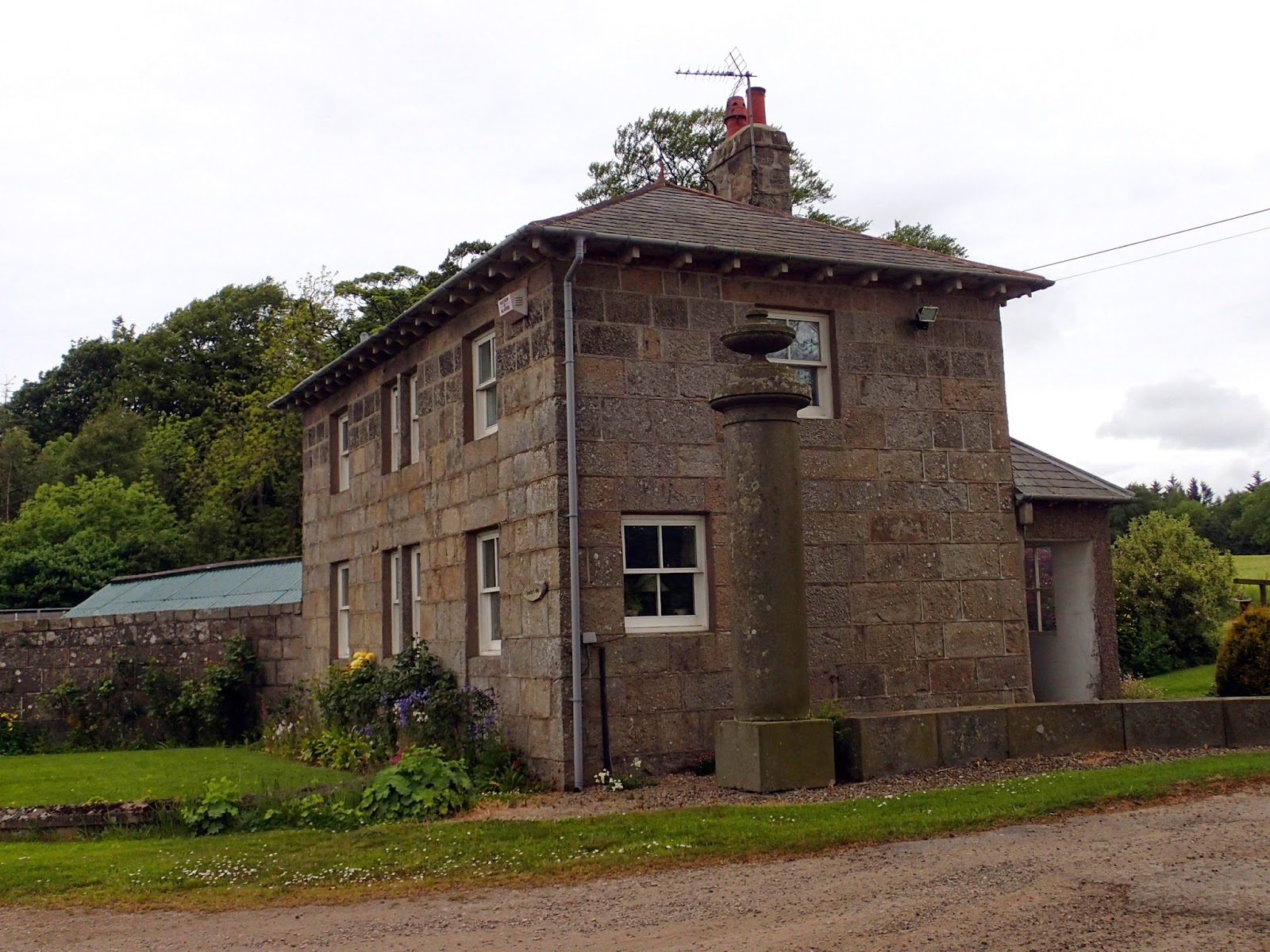
Mintlaw was one of the communities to benefit from the generosity of James Mitchel, factor at Pitfour who left a bequest for the establishment of girls' schools in local communities including Mintlaw. The Mintlaw school was functioning by 1840, the mistress was provided with a two storey house and an annual salary of £15. Mitchel also provided a house for the master of the parish school. Mintlaw Primary School with its distinctive checked frontage, originally a junior secondary school,  opened on Longside Road in 1962 replacing an older school on Station road. A second new  school, Pitfour Primary School opened in 1978 and Mintlaw Academy opened in 1981.


Wednesday 11 June 2014

South Lodge Pitfour

South Lodge from the Line

Seen from the Line the Lodge looks like a displaced council house and was infact almost certainly two semi-detached houses when it was originally built around 1850. The Lodge was extensively altered around 1910 and is now a single dwelling.
 

 Although this was the main entrance to the estate the lodge and imposing gateway were not constructed until about 1850 about thirty years later than the West and East Lodges
As befits the principal  entrance the gateway is  impressive. Incorporated in the entrance is an impossing memorial to   William Pitt, The Younger and Henry Dundas, Viscount Melville, two close parliamentary  friends of James Ferguson MP, 3rd Laird of Pitfour.  The monument consists of two granite pillars topped by Grecian urns flanking curving, low walls bounding the entrance. A large stone panel on the east side of the entrance has a Latin inscription commemorating Pitt and Dundas. This translates as 'To the memory of William Pitt and Henry Dundas, Viscount Melville. Men of ancient virtue. This tribute, from the most durable native granite -than which their fame shall be more lasting - is given by James Ferguson of Pitfour, in the year of Salvation, 1816'.

The wall bounding the estate is  over 5 km long and in places 2mtres high. It  was built at the behest of  James Ferguson MP probably to give employment to his tenants during periods of hardship.


Crimonmogate

Crimonmogate takes its name from a combination of  Gaelic and  Old Norse words which mean ' road through the pasture by the peat moss' said to refer to an ancient track across the estate which originally formed part of the vast lands owned by the Earl of Erroll.
 Crimonmogate is a good example of a classical Regency mansion set in extensive policies. The house, designed by Archibald Simpson,  was commissioned in 1820 by Patrick Milne, a highly successful businessman, who became enormously wealthy as  a result of enterprises in the West Indies, India and China. Milne died before the completion of the house in 1825  and it passed firstly to his relation Sir Charles Bannerman then to  the Carnegie family who lived there until the mid 1900s.

The mansard roof and round headed dormer windows which detract from the lines of the original classical design were added in around 1860


A modern  aerial sculpture representing a trapeze artist balances on  a line between trees in front of the house.

 Beech hedges and mature woodland screen the house from outwith the grounds. During the season shooting parties  heading for Crimonmogate  regularly arrived by train at Lonmay station where  there is a large turning area to accommodate  horse drawn carriages and coaches. Only the trees can be seen from the Line.

 The round sundial, positioned  in front of the house, is dated 1780 , the capital is decorated with Prince of Wales feathers.


This obelisk, dated 1821 was erected by Charles Bannerman in memory of Patrick Milne

During WW2 the head office staff of the Consolidated Pneumatic Tool company were evacuated from London to Fraserburgh and were billeted at Crimonmogate and nearby Cairness. Sasha Carnegie's book 'Pigs I Have known', describes a post war pig keeping venture at Crimonmogate. Christopher Monckton, a cousin to the Carnegies adviser to Margaret Thatcher and  inventor of the board game Eternity lived here  from 1996 - 2000. Monckton offered  a prize of 1million pounds for what he thought was his virtually insoluble board game Eternity. Alas the game was solved within  a period of months forcing the sale of the house.

The yurt in the grounds is used for weddings and other events, it is also popular with  swallows

 In 2001 Crimonmogate was purchased by William and Candida, Viscount and Viscountess Petersham who carried out extensive restoration and now run a successful wedding and corporate events business from the property.

Wednesday 4 June 2014

The former Old Deer Fever Hospital

A short walk from Pitfour along the Line from Taitswell towards Deer Abbey in search of the old fever hospital led to an interesting digression, the discovery of  a badger sett and a circular walk through Pitfour to our starting point. There are several possible circular routes in this area involving attractive walks along the Line and digressions through Aden Park, Old Deer or Pitfour Estate. All are worth exploring, especially by those who dislike 'there and back'  walks for which the Line is often criticised by the unobservant who do not notice how different the coutryside looks when heading in the opposite direction. 

Hawthorn on the embankment close to the bridge carrying the B9030 (Stuartfield) road over the Line. There is a path leading to Aden Park, and Old Deer adjacent  to  the bridge. Crossing the Line the path leads up to the South Lodge of Pitfour and continues within the estate.


Fox-and-cubs or Orange Hawkweed, (Hieracium aurantiacum) grows on the drier section of the permanent way beyond the bridge. Other less striking yellow hawkweeds, flowers of mid summer are also starting to flower. 

A short distance to the west of the bridge in a damp meadow between the the Line and the A950 is this cottage, now enlarged but originally a small 'fever hospital' serving Old Deer.

For a brief period between 1884 and 1906 the small cottage, since extended, operated as a tiny fever hospital. The hospital which only had a handful of beds was situated here to be outside the village but conveniently close to Mavisbank, at that period the home of the Old Deer doctor. Most patients admitted to the hospital would have been suffering from scarlet fever or typhoid fever. The hospital was far too small to handle the number of patients needing to be isolated if there was a major outbreak of an infection and thus closed in 1906, by which time a larger isolation hospital had been opened in Strichen.

South Lodge Pitfour from the Line. The pillar to the right of the Lodge is one of  a pair flanking the main entrance to the estate which form part of a memorial to William Pitt the Younger and Henry Dundas, Viscount Melville.

The former isolation hospital, now modernised and extended.


A network of meandering footpaths has been constructed leading from Old Deer along the bank of  the Ugie, crossing the Line then wandering round the damp, low-lying,  meadow on the north side of the Line. The path eventually leads to Saplinbrae and the Pitfour Estate. The bank just visible in the trees on the far side of the meadow which is home to badgers. The burn which flows through the area carries the outflow from the artificial lake of Pitfour down to the Ugie.
Entrance to a badger sett in the embankment
Looking across the field with the footpaths towards  the old fever hospital  in the middle distance and beyond it the South Lodge. The field has large quantities of damp loving plants such as fragrant meadowsweet, spearwort, pink spikes of  bistort and pale mauve cuckoo flower.