Friday 31 December 2010

Hogmanay Walk: Kirkton to Rathen


Fields flooded with still partially frozen melt water, wreaths of snow on Mormond and in the ditches, is there still more to come?


The flooded fields support large flocks of wildfowl, hundreds of unidentifiable ducks in Wet Fold and on these fields near Kempen Hillock, whooper swans.There were curlews and dismal crows in the fields, a patch of white feathers on the Line  where a pigeon had met its end.

This morning we enjoyed most of an end of year walk from Kirkton to Rathen Station, round by Hillhead of Cairness and Invernorth returning along the line. The last mile was marred by coinciding with another walker who decided to walk along with Rufus and me, completely ruining the last part of the walk. How much one misses when having to emerge from one's head make conversation.The thaw which began several days ago has melted most of the snow but wreaths remain in the shade of the embankments and in places on the line. There are filthy black piles of snow dumped by the snowplough at the roadside The extent of flooding in the fields is extraordinary. By Rathen Station we saw roe deer tracks in the snow and noticed that the young chestnut saplings near the Golf Club have been striped of bark, presumably by the deer.
An original Harper Ironworks gate close to Mill Farm.
Close to Rathen Station this fireplace, complete with fire basket, is all that remains of a linesman's hut. It is usually well hidden by the rosebay willowherb - now reduced to bare stalks.


Friday 10 December 2010

Thaw

What a difference  a few days and a temperature increase can make. Since yesterday morning  the temperature has gradually risen and by this morning had reached a balmy 8.5c. The Line is now merely flecked with patches of ice and snow, as are the fields towards Memsie and Rathen, Mormond Hill remains a monochrome.The fields by the Line, which were under a gleaming white blanket on Tuesday, are now under water. The meltwater from the snow has flooded the fields and filled the ditches alongside the line with icy water. The floods make one more aware of the contours of the land, not as level as it seems.  The ditches are overflowing with mushroom coloured water on which sheets of ice float, the Water of Philorth running fast and high. How easily one could slip down the embankment and quietly drown. The ducks in their pond at Craigewan were standing huffily on a sheet of floating ice. There were geese, gulls and mallards in the floods, starlings, curlews and corvids feeding in the softened fields.Our walk was cut short at Craigewan by the depth of water (with miniature icebergs) in the dip where the road crosses the Line, a digger was trying to clear the drain as we turned back.

Tuesday 7 December 2010

Kirkton Halt to Philorth Halt in the snow

Looking back towards Philorth Halt, ominous snow clouds gathering over the Broch yet again.
This morning there were dire reports of snow related chaos in the Central Belt but only a  couple of centimetres fell over night in Fraserburgh, where it was a crisp sunny morning. Grey Granite and Rufus were inspired to walk down to the Line, side roads are still treacherous and Grey Granite is a coward about driving on snow. We were rewarded for the trudge down the Fraserburgh bypass with  a glorious walk in easy going along the snow covered Line.

Looking towards Rathen from Philorth Halt. Normally our default walk takes us past the farm on the horizon but having walked for an hour before we reached this point we turned back before the Line crosses the Water of Philorth.


Philorth Halt


Rose hips glowing in the sunlight, not many have escaped being eaten. This morning we saw remarkably few birds, just a occasional crows sitting dejectedly on fence posts. 
Rufus getting his lead in a fankle. He tried eating the rose hips and seemed to find them quite palatable.

Thursday 2 December 2010

Kirkton Halt, the Line under snow

After a week of snow, even the section of the Line close to the bents is under about 7 inches of snow. This shot was taken looking towards Fraserburgh close to the site of Kirkton Halt on the St Combs Line.

Tuesday 26 October 2010

Philorth Halt to Rathen: Wildlife Corridor

During the last few days the importance for wild birds of the habitat provided by the Line has become increasingly evident. The uncut vegetation along the trackway now has many ripe seed heads which attract a considerable range of birds. In the short section above broom, gorse knapweed, rosebay willowherb, spear thistle, rose hips burdock and various grasses dominate. There are also willows and occasionally sycamore, hawthorn and apple.

 At present the Line is teeming with bird life. This afternoon we watched a charm of goldfinches feasting on burdock seeds, siskins and a large flock of greenfinches enjoying the willowherbs. A robin, wrens, bluetits, tree sparrows and blackbirds, crows, rooks and assorted gulls were also present. Skeins of geese were constantly passing overhead, a few days ago an elegant line of six swans flew in from the sea.


Late flowering pink campion


There are frequently buzzards mewling as they wheel high over the woods at Carinbulg Castle and foolish pheasants crash about in the grass land. This damp  area is also home to curlews and lapwings. A pair of roe deer graze the fields close to the castle.

Monday 11 October 2010

RNAS Lenabo

The connection between airships and the Formartine Buchan Way may not immediately be apparent but during WW1 there was a direct rail link from Longside Station to RNAS Lenabo, the most northerly of Britain's airship bases. (This is not to be confused with Longside Airfield) The remains of the airship station are extraordinary and worth a digression.
Memorial constructed from the remains of what is thought to have been the Officers' Mess at Lenabo


Lenabo Airship Station (RNAS Longside) was built in 1915 on a vast peat bog in order to provide allied shipping additional protection from German U boats operating in the North Sea. Lenabo consisted of 3 large airship sheds each 100 ft high, each protected by immense windbreak walls. In order to transport materials and personnel efficiently to the site a railway spur was constructed from Longside Station to the base. Over 32, 000 tons of  materials and stores were carried by train to Lenabo. The line was used exclusively for the base, ceased to operate in 1920 and existed only until 1923 when the trackway was removed. A small town consisting of support services, water tanks, gasworks, gasometers, barracks, canteens, a church and a theatre was rapidly constructed on the bog. Some of the peat extracted from the site was used to power the steam scoops, steam lorries, bucket cranes and locomotives used in constructing the site. Around 500 naval personnel were deployed on the site. The effectiveness of the airships is very much open to question and interest in airships generally waned after the war ended. The site was decommissioned in 1920, the buildings were flattened  but the concrete bases and larger chunks of concrete masonry remain mysteriously in what is now an extensive mature woodland.On November 11th 1918 it was a dispatch rider from Lenabo who took official news of the signing of the Armistice to the Peterhead Sentinel.


Following the route of one of the original roads a track from the main gate leads straight ahead to the hangars


The vast concrete floor of one of the airship hangars

The concrete panels which made up the enormous windbreaks remain, like collapsed dominoes, amongst the trees


Huge concrete mooring blocks were used to anchor the airships. The airships were called 'Lenabo soos' by the local farmers. Landing the airships involved everyone on the base,  including the station dog who was trained to assist by grabbing the end of the landing cable which, when thrown from the airship, inevitably landed in a tangled heap. The cable was then passed through an iron ring on a vast concrete block to prevent the airship from rising again.
Normally 100 naval ratings were needed then to manoeuvre the airships in to the sheds by hauling on the landing cable. It was almost impossible to handle the ships in bad weather. Each ship had an emergency panel which could be activated to deliberately  rip the casing causing the gas to escape and the ship to collapse. On 21st September 1918 two coastal airships landed in  a gale, even with 400 men on the ropes it was impossible to get the airships into the sheds in such  a strong wind and they had to be deliberately ripped.

 
On the right of the main gate a track, following the course of one of the original site roads, runs parallel to the main  road and leads to the remains of barracks, the gasworks, coal bunkers (pictured above) and water culverts.


Two of the many covered water culverts which led water  to - or from a large water storage tank related to the gasworks.


Wednesday 29 September 2010

End of the Line: Howe 'o Buchan Crossing to Peterhead

Immediately after the site of the Howe o' Buchan level crossing the walkway crosses a building site. This is an area being developed by Scotia Homes for new housing and is currently largely a vast extent of bare earth although, astonishingly, we did see a charm of goldfinches.

The line crosses a new dual carriage way and is bounded by Horsa fencing until it reaches the back of the ASDA store.
The Collie Burn has been redirected through the channel close to  ASDA

The remainder of the Line passes through housing developments, there is much litter and graffiti, despite reasonable landscaping and frequent litter bins. Some original bridges have been dismantled, here a bridge has been constructed in roughly the style of a railway bridge to carry a new road over the Line.

This undistinguished looking  lane marks the end of the Formartine Buchan Way. The photograph was taken from the car park of Peterhead Academy, built on the site of the former Peterhead Station and goods yard. Disappointingly there is nothing to indicate that this is the case. From the station between 1865 and 1939 a a mile long branch line, used by freight trains, led down to Peterhead harbour.

Peterhead Station opened in July 1862 and closed to passengers in May 1965.  Goods traffic continued until September 1970, largely due to the output of the Crosse and Blackwell Factory.  When 'Crossies' custom was changed to Freightliner the line closure was inevitable since fish traffic, the mainstay of the line, had gradually transferred to road during the 1960's. Much fish was taken to Aberdeen by lorry where it could be containerised for onward transportation by rail.
Peterhead to Fraserburgh by rail was an inconvenient 39 miles by rail as opposed to 19 by road. The journey involved changing trains at Maud and depending on the next connection could take well over 2 hours. The rail route from Peterhead to Aberdeen was 15 miles longer than by road. By the 1960's road travel, firstly by bus and then by private transport proved to be cheaper and more convenient than taking the train leading to a great reduction in rail passengers.

Tuesday 28 September 2010

Howe o Buchan to Newseat

The remains of the level crossing at the slip road near Howe o Buchan, there is a gate for pedestrians on the right. Water for the engine tank at the railway station in Queen Street was piped from the Howe o Buchan Estate and given a suitable fall by being raised to the top of the brae at Blackhouse  by a hydraulic ram. 
The level crossing gates. Visiting this area a few days later Grey Granite noticed that extensive earthworks and flattening of trees have been carried out. It is to be hoped that this does not destroy the crossing gate posts.

This walk was characterised by the bright haws along the line and the disappointing graffiti under many of the bridges between Howe o' Buchan and Inverugie. Boulders along the track side here are pink Peterhead granite.
Inverugie station is now rather disappointing, the station building, which was rather grander than most, is hidden from the line by the wall. In view of the level of graffiti and litter on the line the building of the wall is entirely understandable.


The back of Inverugie Station.
 'The Howes o Buchan' records that in the1860's  there was 'much excursion traffic to the station, attracted by the beautiful walks and interesting ruins in the vicinity'. These include Inverugie Castle associated with the Keiths, Earls Marischal and a prophecy of Thomas the Rhymer. Grey Granite has been told that until the mid 20th century a popular Spring outing from Peterhead was to take the train from Peterhead Station to Inverugie to visit the Pinkie Braes there. Just beyond the station the Line is crossed by a minor road to Longside. At this crossing  the remains of the bridge which would have taken the line over the road can be seen. Inverugie Station closed to goods traffic in November 1960 and to passengers in May1965.


The bridge carrying the road to Berryhill farm has wooden railings
 
The line is pleasantly bounded along this section by deciduous woods containing specimens of large well established trees including ash,beech and horse chestnut. The line is again crossed by several fuel pipe lines from St Fergus Gas Terminal
The bridge at Ellishill, here there are steep steps leading from the line to the road.The embankment close to Ellishill is 18.5 feet high hence the polite notice asking that, for safety reasons, the gate at the top of the steps be closed.

Looking towards Newseat from the Ellishill Bridge across one of the longest
'straights' on the Peterhead- Maud section of the line.

Longside Airfield, still used by light aircraft which were landing and taking off as we walked by.  During WW2 Newseat Halt was used by RAF personnel from the base.

Peterhead Airfield was built for the RAF in 1941, between Longside and Peterhead, and disbanded in 1945. At its busiest, there was in excess of 2,000 personnel stationed there, typically 1,576 RAF and 289 WAF, with up to five accommodation camps in use, serving a large number of RAF squadrons, and up to four Fleet Air Arm (FAA) squadrons. Amongst the nations represented were Australians, Canadians, New Zealanders. Poles, Czechoslovaks, Belgians, and Americans. Squadrons of particular note would include the RAF 13th Group (Night Fighters) the Royal Canadian Air force (416 Squadron) and the Polish Air Force (309 Squadron). Records suggest the airfield was used as a fighter station operating Hurricane, Spitfire, and Mustang aircraft, and provided protection for eastern convoys.


May-July 1944, 416 Squadron formed at Peterhead on November 18, 1941. In the same month, one person was killed, and three others injured, when a Ju-88 bomber dropped two bombs on the airfield.  (Secret Scotland)

Approaching Newseat halt from Peterhead. The platform appears to have been faced with wood, rather than the more usual  stone.


After returning to the Howe o'Buchan level crossing Grey Granite decided to walk a short way towards Peterhead Station. This involved crossing a hideous development area which was  a sea of bare earth with patches of weed. In the midst of this we were delighted to see a large charm of goldfinches feeding on thistle and charlock seeds.

Wednesday 22 September 2010

Philorth to Rathen a new perspective

Grey Granite recently looked at some old photographs of Philorth Halt when it functioned as a station. From these it has become clear that the iron gate  in front of the wooden fence is actually part of the level crossing gate. This gate controlled the crossing of the Line and the access road to Philorth Estate, there is a narrow wooden pedestrian gate beneath the honeysuckle. The ivy clad pillars behind the fence supported the station name.
It was only yesterday that Grey Granite noticed that the skyline of Fraserburgh can be seen from Rathen station and for most of the way as one heads along the Line to the Broch. In the photograph above, Kinaird Head Lighthouse can just be made out on the right close to the tower of the Dalrymple Hall and spire of the South Church.
Red rose hips and sunny stubble fields towards Invernorth

Friday 17 September 2010

Longside to Newseat Halt


A tanglement of Russian Vine (Fallopia aubertii) on the embankment at Longside
The most productive and established of the allotments between Longside Station and the golf course which is alongside the first part of the route
This delightful allotment includes what are presumably green manure crops, in the foreground Facillia julia which was attracting swarms of insects including bees and hover flies.

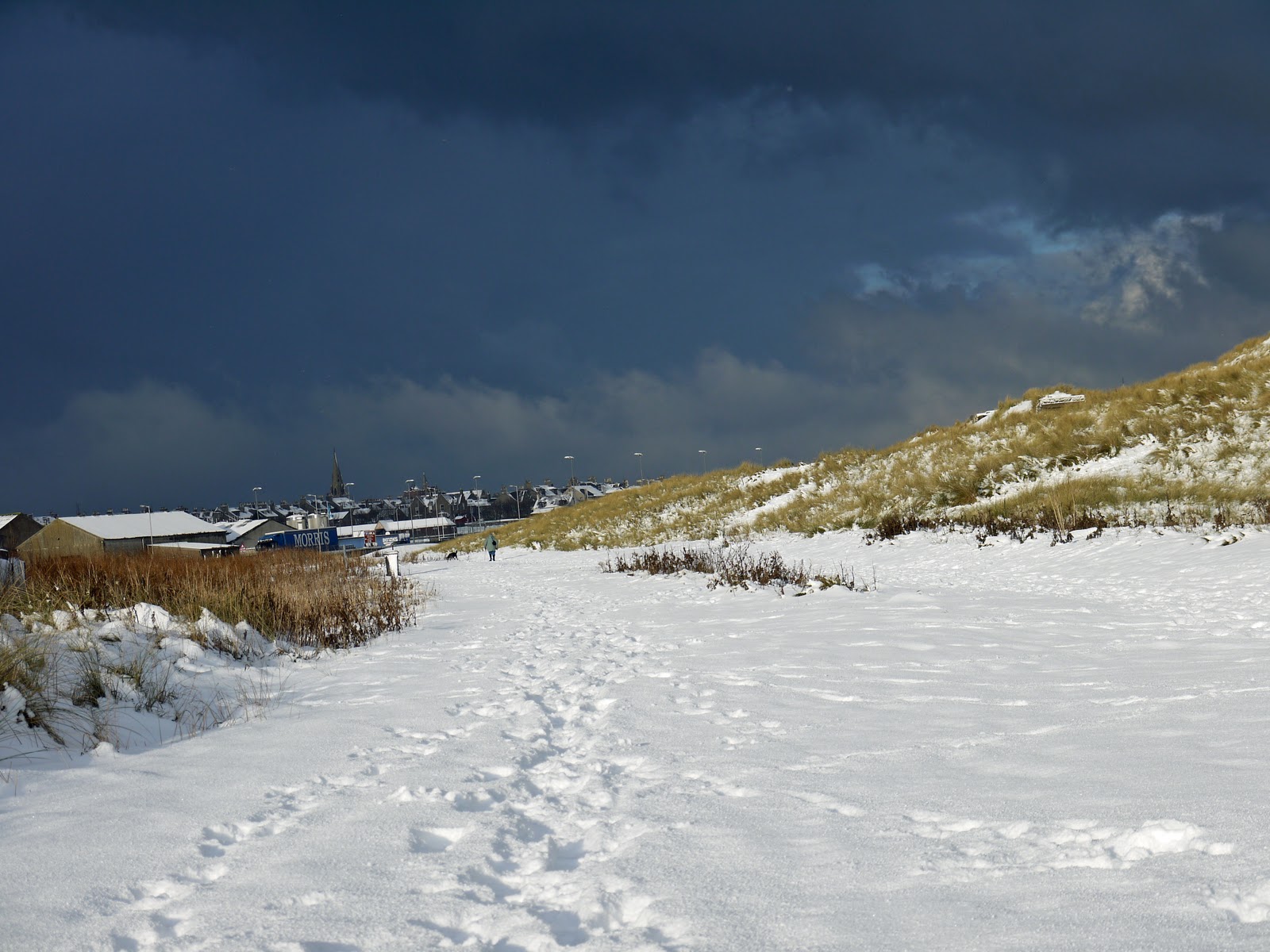
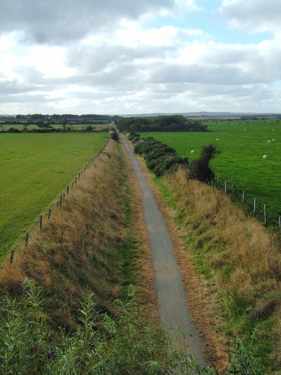
The 2.5 mile Longside to Newseat stretch of line, proved to be a very pleasant walk, a complete contrast to the dispiriting  Mintlaw to Mintlaw Station section. The line to Newseat passes through flat pleasant countryside, peaceful apart from the mild lawn mower buzz of micro lights and light aircraft, presumably from Longside Airfield. Much of the section is on a shallow embankment giving views across the Howe of Rora, dominated by a large sand/gravel quarry in the distance.

The Howes o' Buchan (1865) waxes lyrical in describing Rora, 'The view of Rora obtained from the line at this point is a most enchanting one. The slightly rising ground, the neat and compact farm-houses characteristic of this part of the country, and the fields arrayed in their thick mantle of living green, all tend at once to gratify the sense and charm the eye by their silent suggestions of honest plenty and well rewarded toil'.

Looking North across the Howe of Rora from Willowbank, Mormond Hill on the skyline


The bridge over the line at Strawberrybank.

Much of this section of the line has whins, broom and willowherb growing in great profusion along the embankments. On the sunny Sunday afternoon on which Grey Granite and Rufus walked it, the gorse and broom pods were loudly cracking in the heat. The whin bushes in particular were covered in spiders' webs which in turn had caught the drifting clouds of willowherb seeds giving the bushes a ghostly Miss Haversham look.


At the stand of trees visible through the bridge in the previous picture, (mainly elders, ash and beeches) the line crosses a tributary of the Ugie.


Again The Howes o' Buchan:
'The River Ugie is crossed by a handsome and substantial metal bridge of three spans, with metal girders, the arches being about eighteen feet apart, and piers of solid masonry.' 
From  the north side of the track, just before the bridge a footpath veers back towards Longside via Auchlee (1.5km)
Reference is also made in 'The Howes' to the ruins of Auchlee Mills which were established towards the end of the 18th century by Thomas and Robert Kilgour of Kinmundy. These woollen mills, powered by diverted water from the Loch of Auchlee, at first prospered and employed a 'large number of hands -a number of them being at Kinmundy as woolcombers'. However, the Kilgours became bankrupt in 1828, their liabilities were £30,000 and their assets only raised 2s 10d (under 15p) in the pound.This seems to have been related to a general crisis in the wollen industry at the time. There had been heavy local investment by both the wealthy and 'every cottar or labourer who could scrape together a few pounds (and) put it into the hands of the Kilgours. Nowhere, in their opinion, could be so safe -not even 'in the bank'.' Many locals lost their enitire savings when the venture unexpectedly collapsed.


Beyond the bridge over the Ugie the line is, unusually bounded by dykes rather than fencing as elsewhere.This continues until the Bridge of Bruthlaw.
The section of line immediately beyond Mains of Bruthlaw and before the Newseat cutting, is raised on a low embankment. Two pipe lines from St Fergus power station cross under the line.
A cutting, with banks thick with gorse, broom and willow herb, leads to Newseat Station.

The station is situated close to to the ivy clad bridge from which a precarious path gives access to the line.
Newseat Halt from the bridge.