Showing posts with label birds. Show all posts

Saturday, 2 March 2013

Lonmay Station, through Spillarsford to Craigellie


The section of Line between Lonmay Station and Craigellie is usually extremely wet and difficult to negotiate, particularly between Spillarsford and Craigellie where stagnant water often covers the pathway. We took advantage of a hard frost to re walk this otherwise attractive stretch. 
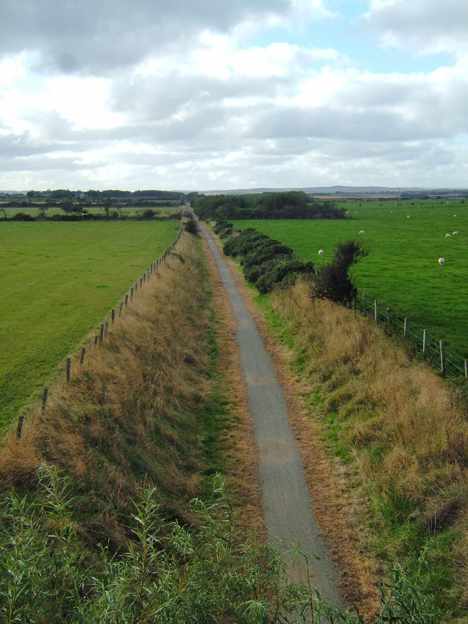
Looking from Spillarsford towards Craigellie. Despite the frost there was a bright sprinkling of gorse flowers and  a few silky pussy willow catkins opening on line side trees. The morning felt spring-like as the sun rapidly melted the frost. There were larks singing overhead, skeins of geese heading inland from Strathbeg reserve and a small flock of lapwings tumbling  in the air on the Craigellie side of the Line.
Cortes village seen from just north of Lonmay Station. Originally this small settlement, close to the Peterhead Fraserburgh Turnpike,   was known as Spillarsford from the farm, now a ruin, seen in the trees on the extreme right. Cortes House is about half a mile to the west of the village.The hamlet is actually in Rathen parish being on the Rathen side of the Ellie Burn, the boundary between Lonmay and Rathen. The name Lonmay is thought to be derived from 'Long meadow' and the district has long been famed for the quality of the early potatoes grown on the sandy podsol. The 3rd Statistical account (1960) records the production of seed potatoes for export to England and South Africa. Earlier editions of the Statistical Account indicate that the area contained extensive bog and has been laboriously reclaimed.During the 19th century seaweed, carted from the shores at Cairnbulg and St Combs was used as an effective fertiliser. 

Cairness House seen from the Line near Spillarsford Farm.

The estates of Cairness, Craigellie and Crimonmogate sprawl to the east of the Line, Cortes House is to the west close to  the junction of the Aberdeen to Fraserburgh and Peterhead to Fraserburgh turnpikes.
Spillarsford Farm, long abandoned and now an unseemly ruin on the Lonmay side of the Ellie. 

Close to the Line a little to the north of Spillarsford Farm, this set of ruins,inhabited until the 1970s,  once a mill and  rather more picturesque than the farm, was reached by  a rack running across the fields from Spillarsford.


The lower of the mill ruins, the bank between the mill and the burn has drifts of snow drops.
The beautifully detailed1st edition 25 inch to the mile OS map, dated 1870, shows the mill wheel in position on the gable end of this building, just above the  snowdrops. It also shows a small body of water close to the buildings, probably the mill dam, and the mill lade running under the bridge over the Line from which these photographs were taken. 
Hillhead of Craigellie Farm, the tower is an ornamental dove cot, rising incongruously from the steading. The trees in the background are part of the Craigellie policies.

The 1870 OS map shows a small cluster of cottages at Spillarsford of these the Poorhouse seen above and Station Cottage, below are labelled. This poor house served Rathen parish. A locally administered poorhouse was established in Rathen by 1860. Map evidence indicates that it  seems to have become defunct by around 1900 when  a new edition of the OS map was published.

This large imposing building at Lonmay Station (above) was the bank, the station agent lived in the small cottage below, Station Cottage, Spillarsford.There was also a shoemaker and small general store amongst the cluster of Spillarsford houses. Lonmay Station, yet another relatively isolated station, was convenient for Crimonmogate. In season shooting parties alighted at Lonmay and there was a typically large turning area for coaches and carriages outside the station. At the height of the herring season it was common for open fish wagons waiting for the Fraserburgh catch to be held at the sidings at Lonmay until there was room at Fraserburgh.

Wednesday, 8 August 2012

Auchnagatt to Savoch

On a blisteringly hot morning Grey Granite and Rufus walked down from Auchnagatt towards Arnage, such was the heat that they left the line at Burngrains Bridge and went to look for a suitable parking place for the next leg of their trek. This took them to Savoch Kirkyard, which they had seen on the horizon from Elrick Trout Fishery.

Walking south from Auchnagatt we again followed the Ebrie Burn and had the sense of walking through a wide amphitheatre surrounded by rolling farmland. The land adjacent to the Line was again damp and rushy, willows, alders and the occasional oak grow alongside the trackway. Unfortunately, traffic on the A948 disturbs the tranquillity of this section until the road and railway diverge close to the  Mill of Elrick
The Mill of Elrick,  note the solar panels on the roof of the mill which a has diversified by becoming a a trout fishery. There are several large ponds alongside the Line.


Looking west across one of the Mill of Elrick fish ponds Savoch Church may be seen on the skyline. Grey Granite is certain that the large bird she saw rising from one of the ponds was an osprey.

Enormous butterwort leaves by the mill.

The Ebrie Burn crosses and recrosses the Line in many places,  here it is densely lined with the willows which were used for basket making in the Auchnagatt area.


Savoch Church

The isolated church, now redundant, commands impressive views over beautiful rolling farmland and is situated about a quarter a mile west of  the Line near Ebrie Lodge (Leave the Line at Burngrains Bridge. The congregation would have consisted of the people from Auchnagatt, where there is no church,   and the surrounding countryside. Grey Granite noted the boot scrapers still on either side of the front door.
Savoch Church,  a originally Chapel of Ease for those living in the district,  was erected by subscription in 1834.The church has  a rectangular plan with a birdcage belfry at the east gable where there is also a porch. In May 1851 the Court of Teinds raised Savoch to the status of a parish formed from portions of New Deer, Old Deer, Ellon, Methlick and Tarves parishes. The terraced church yard was opened in 1877 when the church building greatly was improved. As part of the renovation the stained glass windows which can be seen  from the outside of the building were made and installed on either side of the pulpit. One window was presented by Mrs Udny of Udny, the other by the church's Woman's Guild. Savoch Church closed in October 1997. 
The belfry above the east gable east gable seen from the lower terrace of the kirkyard.

The inscription on this obelisk states 'That the churchyard  laid out by the parishioners at a cost of £300 was opened in 1877. The obelisk is visible on the upper terrace in the photograph above.


The elegant pink granite obelisk on the lower terrace of the kirkyard overlooks the beautiful farmland of the parish.Tellingly this records 39 deaths in WW1 and 4 from WW2. The devastatingly large list from 1914-18 includes William Milne DCM, William Robb MM .


On this lower terrace there are excellent examples of Victorian gravestones, many of polished granite topped with granite urns.

This stone close to the church on the upper terrace has a draped urn, popular in mid  Victorian times and the inscription:
Erected by James Gordon, Station Agent Auchnagatt in memory of his beloved son Robert died 23 August 1881, aged 4 years.
The Bridge over the Line at Burngrains, walking back to Auchnagatt we were very glad of the slight shade afforded by the bushes and trees in cutting from here to Mill of Elrick. There is a  path up the embankment by the bridge and parking at Savoch Church which will enable our walk to be resumed from this point.

Saturday, 8 October 2011

Den of Old Maud

Maud Junction,  a distinctly autumnal look with fallen leaves. The lay out of the station reflected the need for lines to split to serve Peterhead and Fraserburgh and for the extensive goods yards needed by the cattle mart. The Peterhead platform is on the right, the Fraserburgh ones to the left, the goods yard was further left.


Maud Hospital,  originally the Buchan Combination Poorhouse, this imposing building designed by Alexander Ellis, was opened on 26th January 1869 in order to provide deliberately spartan accommodation for the poor of parishes across Buchan. This view from the Line just south of  Maud Station shows the side of the building. The presence of the railway and resultant good links across Buchan was a factor in the selection of Maud as the site for the poorhouse. The poorhouse assisted the development of Maud by providing employment for local tradesmen and craftsmen, including tailors who made uniforms from tweed and corduroy for the inmates, joiners who did maintenance work and made coffins. The school roll was considerably increased by the number of child inmates.


Buchan Combination Poorhouse, now Maud Hospital, from Hospital Road. The institution was taken over by Aberdeen County Council in 1930 when it became known as Maud Home. At this time it catered for 160 including 'ordinary poor, mental defectives, harmless lunatics and chronic sick'. The building was described as having 'narrow dark central corridors, with day rooms and dormitories on either side, enjoying neither cross light or cross ventilation'. The home was handed  over to the National Health Service in 1948 and became known as Maud Hospital.


The Line snakes along the eastern edge of  the Den of Old Maud, chiefly on an shallow embankment. On either side the land is marshy, there are extensive areas of ash trees and occasional willows and rowans in the den. As we walked along this section a single buzzard, flying high over the den was being mobbed by a group of rooks to which it remained indifferent. 
The willow herb seeds along the Line provided food for a flock of finches
.

At the southern end of the Den there is a stand of immense beech trees one of which has recently lost a huge branch. The torn limb revealed rotten wood at its junction with the trunk but had this year's leaves on the branches.
Rusty leaves and beech mast littering the path.

Tuesday, 20 September 2011

Philorth to Rathen Station

Ripening brambles near Rathen Station
Grey Granite and Rufus have continued to walk the line throughout the summer but it has been inexplicably  impossible to upload onto the blog. Hopefully normal postings can now be resumed.

Today we walked from Philorth Halt to Rathen Station in beautiful, warm autumnal sunshine. The Line has already taken on a distinctly autumnal look. There are few flowers remaining on this stretch, the brightest colour comes from fruits and seeds along the path side. Small flocks of crows were sitting on the Line returning to the harvested grain fields as we approached. Three buzzards wheeled and high cried over Philorth woods.
Despite the autumnal look of the Line it was very warm and as we walked broom seed pods were bursting noisily.

Rosebay willow herb seed head, the long seeds were drifting across the line like threads of spider webs.

Dog rose hips, many exposed bushes have already shed their leaves

A line of exposed trees behind Philorth Halt has already been striped bare by the recent gales.

Wednesday, 4 May 2011

Rathen Station to Rathen village

Rathen Station is about a mile from the village it served.  This morning we decided to walk from the station to the village along the most direct route, before returning along the Line which we rejoined where it is crossed by the B9107 at The Leas. On a beautiful sunny May morning this made an enjoyable round trip of approaching 5 miles. There were skylarks, buzzards and an anxious tumble of nesting lapwings along our route and we noted the first heartease pansies and Herb Robert of the year on the sandy track over Gallows Hill.

A steepish sandy track leads over Gallows Hill and down into the village. There are good panoramic views towards Mormond and over to the Broch, the landscape a colourful Spring patchwork of greening grass and the flourescent yellow of oilseed rape.


St Ethernan's Church is on the left of the track as one enters the village.There are interesting gravestones, including that of Edvard Grieg's Great Grandparents. Corpses from Strichen were carried over Mormond Hill to be buried here prior to Strichen becoming a parish in its own right.

The plain birdcage belfry dated 1782

The diamond shaped wall sundial, which alas, lacks a gnomon, is dated 1625

The south aisle of the church has this ogee-arched aumbry and an inscription declaring Alexander of Philorth to be the patron.
 
The name Rathen may be a corruption of the saint's name or could be from the Gaelic for a round fort on a stream.  St Ethernan  (or Eddren) is thought to have been a  Pict of noble birth who studied religion in Ireland during the sixth century. He returned to Scotland where he travelled northwards as a missionary, establishing several religious settlements,  before  eventually reaching the Rathen area. St Ethernan lived as a hermit in a hollow on the East side of Mormond Hill, known as St Eddren's Slack, dying there on December 2nd, 668. Records dating from the 13th century mention a 'parson of Rathen' but there are no remains of the original church. However, Rathen is one of the oldest sites of continuous Christian worship in the North East

Adjacent to the old church is the Gothic church which replaced it in 1868, the broach spire is a prominent landmark

The Line close to Concraigs. The warm sun accentuated the coconut scent of the gorse and attracted many insects, there were small clouds of small white, small tortoiseshell and green viened white butterflies.

Saturday, 29 January 2011

Rathen to Kirkton


A glorious sunny morning, the beauty of the day overshadowed by frequent shots and pheasant scaring noises from a shoot in the woods at Cairnbulg Castle. There was also someone preparing to fly a hawk in the field by Kirkton Cemetery where there is a large rabbit colony. Following a walk along the bents to the Water of Philorth,  we walked back along the Line from Rathen Station to Kirkton.   We were privileged to see a magnificent buzzard wheeling over head near Islamor and being mobbed by crows.
A small patch of snowdrops growing by the approach to the Line at the Craigiewan

The bark of some apple trees, the occasional sycamore and a horse chestnut sapling along the Line has been nibbled by deer during the harsh snowy weather. None of the willows appear to have been eaten. We frequently see roe deer in the fields next to this stretch of Line. 

Friday, 31 December 2010

Hogmanay Walk: Kirkton to Rathen


Fields flooded with still partially frozen melt water, wreaths of snow on Mormond and in the ditches, is there still more to come?


The flooded fields support large flocks of wildfowl, hundreds of unidentifiable ducks in Wet Fold and on these fields near Kempen Hillock, whooper swans.There were curlews and dismal crows in the fields, a patch of white feathers on the Line  where a pigeon had met its end.

This morning we enjoyed most of an end of year walk from Kirkton to Rathen Station, round by Hillhead of Cairness and Invernorth returning along the line. The last mile was marred by coinciding with another walker who decided to walk along with Rufus and me, completely ruining the last part of the walk. How much one misses when having to emerge from one's head make conversation.The thaw which began several days ago has melted most of the snow but wreaths remain in the shade of the embankments and in places on the line. There are filthy black piles of snow dumped by the snowplough at the roadside The extent of flooding in the fields is extraordinary. By Rathen Station we saw roe deer tracks in the snow and noticed that the young chestnut saplings near the Golf Club have been striped of bark, presumably by the deer.
An original Harper Ironworks gate close to Mill Farm.
Close to Rathen Station this fireplace, complete with fire basket, is all that remains of a linesman's hut. It is usually well hidden by the rosebay willowherb - now reduced to bare stalks.


Friday, 10 December 2010

Thaw

What a difference  a few days and a temperature increase can make. Since yesterday morning  the temperature has gradually risen and by this morning had reached a balmy 8.5c. The Line is now merely flecked with patches of ice and snow, as are the fields towards Memsie and Rathen, Mormond Hill remains a monochrome.The fields by the Line, which were under a gleaming white blanket on Tuesday, are now under water. The meltwater from the snow has flooded the fields and filled the ditches alongside the line with icy water. The floods make one more aware of the contours of the land, not as level as it seems.  The ditches are overflowing with mushroom coloured water on which sheets of ice float, the Water of Philorth running fast and high. How easily one could slip down the embankment and quietly drown. The ducks in their pond at Craigewan were standing huffily on a sheet of floating ice. There were geese, gulls and mallards in the floods, starlings, curlews and corvids feeding in the softened fields.Our walk was cut short at Craigewan by the depth of water (with miniature icebergs) in the dip where the road crosses the Line, a digger was trying to clear the drain as we turned back.

Tuesday, 26 October 2010

Philorth Halt to Rathen: Wildlife Corridor

During the last few days the importance for wild birds of the habitat provided by the Line has become increasingly evident. The uncut vegetation along the trackway now has many ripe seed heads which attract a considerable range of birds. In the short section above broom, gorse knapweed, rosebay willowherb, spear thistle, rose hips burdock and various grasses dominate. There are also willows and occasionally sycamore, hawthorn and apple.

 At present the Line is teeming with bird life. This afternoon we watched a charm of goldfinches feasting on burdock seeds, siskins and a large flock of greenfinches enjoying the willowherbs. A robin, wrens, bluetits, tree sparrows and blackbirds, crows, rooks and assorted gulls were also present. Skeins of geese were constantly passing overhead, a few days ago an elegant line of six swans flew in from the sea.


Late flowering pink campion


There are frequently buzzards mewling as they wheel high over the woods at Carinbulg Castle and foolish pheasants crash about in the grass land. This damp  area is also home to curlews and lapwings. A pair of roe deer graze the fields close to the castle.

Tuesday, 28 September 2010

Howe o Buchan to Newseat

The remains of the level crossing at the slip road near Howe o Buchan, there is a gate for pedestrians on the right. Water for the engine tank at the railway station in Queen Street was piped from the Howe o Buchan Estate and given a suitable fall by being raised to the top of the brae at Blackhouse  by a hydraulic ram. 
The level crossing gates. Visiting this area a few days later Grey Granite noticed that extensive earthworks and flattening of trees have been carried out. It is to be hoped that this does not destroy the crossing gate posts.

This walk was characterised by the bright haws along the line and the disappointing graffiti under many of the bridges between Howe o' Buchan and Inverugie. Boulders along the track side here are pink Peterhead granite.
Inverugie station is now rather disappointing, the station building, which was rather grander than most, is hidden from the line by the wall. In view of the level of graffiti and litter on the line the building of the wall is entirely understandable.


The back of Inverugie Station.
 'The Howes o Buchan' records that in the1860's  there was 'much excursion traffic to the station, attracted by the beautiful walks and interesting ruins in the vicinity'. These include Inverugie Castle associated with the Keiths, Earls Marischal and a prophecy of Thomas the Rhymer. Grey Granite has been told that until the mid 20th century a popular Spring outing from Peterhead was to take the train from Peterhead Station to Inverugie to visit the Pinkie Braes there. Just beyond the station the Line is crossed by a minor road to Longside. At this crossing  the remains of the bridge which would have taken the line over the road can be seen. Inverugie Station closed to goods traffic in November 1960 and to passengers in May1965.


The bridge carrying the road to Berryhill farm has wooden railings
 
The line is pleasantly bounded along this section by deciduous woods containing specimens of large well established trees including ash,beech and horse chestnut. The line is again crossed by several fuel pipe lines from St Fergus Gas Terminal
The bridge at Ellishill, here there are steep steps leading from the line to the road.The embankment close to Ellishill is 18.5 feet high hence the polite notice asking that, for safety reasons, the gate at the top of the steps be closed.

Looking towards Newseat from the Ellishill Bridge across one of the longest
'straights' on the Peterhead- Maud section of the line.

Longside Airfield, still used by light aircraft which were landing and taking off as we walked by.  During WW2 Newseat Halt was used by RAF personnel from the base.

Peterhead Airfield was built for the RAF in 1941, between Longside and Peterhead, and disbanded in 1945. At its busiest, there was in excess of 2,000 personnel stationed there, typically 1,576 RAF and 289 WAF, with up to five accommodation camps in use, serving a large number of RAF squadrons, and up to four Fleet Air Arm (FAA) squadrons. Amongst the nations represented were Australians, Canadians, New Zealanders. Poles, Czechoslovaks, Belgians, and Americans. Squadrons of particular note would include the RAF 13th Group (Night Fighters) the Royal Canadian Air force (416 Squadron) and the Polish Air Force (309 Squadron). Records suggest the airfield was used as a fighter station operating Hurricane, Spitfire, and Mustang aircraft, and provided protection for eastern convoys.


May-July 1944, 416 Squadron formed at Peterhead on November 18, 1941. In the same month, one person was killed, and three others injured, when a Ju-88 bomber dropped two bombs on the airfield.  (Secret Scotland)

Approaching Newseat halt from Peterhead. The platform appears to have been faced with wood, rather than the more usual  stone.


After returning to the Howe o'Buchan level crossing Grey Granite decided to walk a short way towards Peterhead Station. This involved crossing a hideous development area which was  a sea of bare earth with patches of weed. In the midst of this we were delighted to see a large charm of goldfinches feeding on thistle and charlock seeds.