Showing posts with label St Fergus gas. Show all posts

Tuesday, 28 September 2010

Howe o Buchan to Newseat

The remains of the level crossing at the slip road near Howe o Buchan, there is a gate for pedestrians on the right. Water for the engine tank at the railway station in Queen Street was piped from the Howe o Buchan Estate and given a suitable fall by being raised to the top of the brae at Blackhouse  by a hydraulic ram. 
The level crossing gates. Visiting this area a few days later Grey Granite noticed that extensive earthworks and flattening of trees have been carried out. It is to be hoped that this does not destroy the crossing gate posts.

This walk was characterised by the bright haws along the line and the disappointing graffiti under many of the bridges between Howe o' Buchan and Inverugie. Boulders along the track side here are pink Peterhead granite.
Inverugie station is now rather disappointing, the station building, which was rather grander than most, is hidden from the line by the wall. In view of the level of graffiti and litter on the line the building of the wall is entirely understandable.


The back of Inverugie Station.
 'The Howes o Buchan' records that in the1860's  there was 'much excursion traffic to the station, attracted by the beautiful walks and interesting ruins in the vicinity'. These include Inverugie Castle associated with the Keiths, Earls Marischal and a prophecy of Thomas the Rhymer. Grey Granite has been told that until the mid 20th century a popular Spring outing from Peterhead was to take the train from Peterhead Station to Inverugie to visit the Pinkie Braes there. Just beyond the station the Line is crossed by a minor road to Longside. At this crossing  the remains of the bridge which would have taken the line over the road can be seen. Inverugie Station closed to goods traffic in November 1960 and to passengers in May1965.


The bridge carrying the road to Berryhill farm has wooden railings
 
The line is pleasantly bounded along this section by deciduous woods containing specimens of large well established trees including ash,beech and horse chestnut. The line is again crossed by several fuel pipe lines from St Fergus Gas Terminal
The bridge at Ellishill, here there are steep steps leading from the line to the road.The embankment close to Ellishill is 18.5 feet high hence the polite notice asking that, for safety reasons, the gate at the top of the steps be closed.
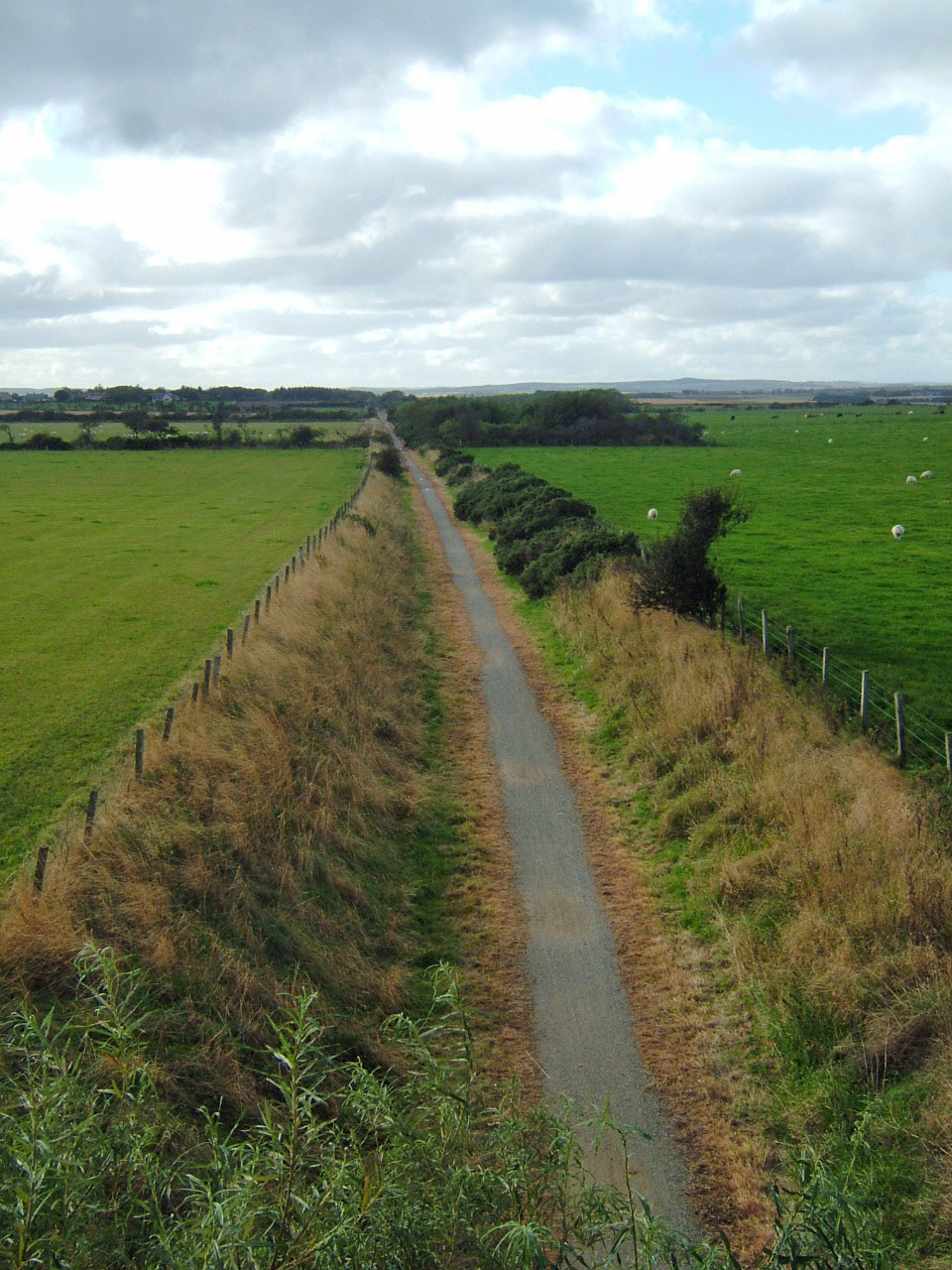
Looking towards Newseat from the Ellishill Bridge across one of the longest
'straights' on the Peterhead- Maud section of the line.

Longside Airfield, still used by light aircraft which were landing and taking off as we walked by.  During WW2 Newseat Halt was used by RAF personnel from the base.

Peterhead Airfield was built for the RAF in 1941, between Longside and Peterhead, and disbanded in 1945. At its busiest, there was in excess of 2,000 personnel stationed there, typically 1,576 RAF and 289 WAF, with up to five accommodation camps in use, serving a large number of RAF squadrons, and up to four Fleet Air Arm (FAA) squadrons. Amongst the nations represented were Australians, Canadians, New Zealanders. Poles, Czechoslovaks, Belgians, and Americans. Squadrons of particular note would include the RAF 13th Group (Night Fighters) the Royal Canadian Air force (416 Squadron) and the Polish Air Force (309 Squadron). Records suggest the airfield was used as a fighter station operating Hurricane, Spitfire, and Mustang aircraft, and provided protection for eastern convoys.


May-July 1944, 416 Squadron formed at Peterhead on November 18, 1941. In the same month, one person was killed, and three others injured, when a Ju-88 bomber dropped two bombs on the airfield.  (Secret Scotland)

Approaching Newseat halt from Peterhead. The platform appears to have been faced with wood, rather than the more usual  stone.


After returning to the Howe o'Buchan level crossing Grey Granite decided to walk a short way towards Peterhead Station. This involved crossing a hideous development area which was  a sea of bare earth with patches of weed. In the midst of this we were delighted to see a large charm of goldfinches feeding on thistle and charlock seeds.

Friday, 17 September 2010

Longside to Newseat Halt


A tanglement of Russian Vine (Fallopia aubertii) on the embankment at Longside
The most productive and established of the allotments between Longside Station and the golf course which is alongside the first part of the route
This delightful allotment includes what are presumably green manure crops, in the foreground Facillia julia which was attracting swarms of insects including bees and hover flies.

The 2.5 mile Longside to Newseat stretch of line, proved to be a very pleasant walk, a complete contrast to the dispiriting  Mintlaw to Mintlaw Station section. The line to Newseat passes through flat pleasant countryside, peaceful apart from the mild lawn mower buzz of micro lights and light aircraft, presumably from Longside Airfield. Much of the section is on a shallow embankment giving views across the Howe of Rora, dominated by a large sand/gravel quarry in the distance.

The Howes o' Buchan (1865) waxes lyrical in describing Rora, 'The view of Rora obtained from the line at this point is a most enchanting one. The slightly rising ground, the neat and compact farm-houses characteristic of this part of the country, and the fields arrayed in their thick mantle of living green, all tend at once to gratify the sense and charm the eye by their silent suggestions of honest plenty and well rewarded toil'.

Looking North across the Howe of Rora from Willowbank, Mormond Hill on the skyline


The bridge over the line at Strawberrybank.

Much of this section of the line has whins, broom and willowherb growing in great profusion along the embankments. On the sunny Sunday afternoon on which Grey Granite and Rufus walked it, the gorse and broom pods were loudly cracking in the heat. The whin bushes in particular were covered in spiders' webs which in turn had caught the drifting clouds of willowherb seeds giving the bushes a ghostly Miss Haversham look.


At the stand of trees visible through the bridge in the previous picture, (mainly elders, ash and beeches) the line crosses a tributary of the Ugie.


Again The Howes o' Buchan:
'The River Ugie is crossed by a handsome and substantial metal bridge of three spans, with metal girders, the arches being about eighteen feet apart, and piers of solid masonry.' 
From  the north side of the track, just before the bridge a footpath veers back towards Longside via Auchlee (1.5km)
Reference is also made in 'The Howes' to the ruins of Auchlee Mills which were established towards the end of the 18th century by Thomas and Robert Kilgour of Kinmundy. These woollen mills, powered by diverted water from the Loch of Auchlee, at first prospered and employed a 'large number of hands -a number of them being at Kinmundy as woolcombers'. However, the Kilgours became bankrupt in 1828, their liabilities were £30,000 and their assets only raised 2s 10d (under 15p) in the pound.This seems to have been related to a general crisis in the wollen industry at the time. There had been heavy local investment by both the wealthy and 'every cottar or labourer who could scrape together a few pounds (and) put it into the hands of the Kilgours. Nowhere, in their opinion, could be so safe -not even 'in the bank'.' Many locals lost their enitire savings when the venture unexpectedly collapsed.


Beyond the bridge over the Ugie the line is, unusually bounded by dykes rather than fencing as elsewhere.This continues until the Bridge of Bruthlaw.
The section of line immediately beyond Mains of Bruthlaw and before the Newseat cutting, is raised on a low embankment. Two pipe lines from St Fergus power station cross under the line.
A cutting, with banks thick with gorse, broom and willow herb, leads to Newseat Station.

The station is situated close to to the ivy clad bridge from which a precarious path gives access to the line.
Newseat Halt from the bridge.

Saturday, 10 July 2010

Maud railway museum


Grey Granite paid a fascinating visit to Maud railway museum this afternoon. Maud was the junction at which trains to Peterhead and Fraserburgh split, there was also a cattle mart.

There is an excellent display of memorabilia. Notable were  the pouch which was necessary for trains to travel on the single line track, a sign, unique to Buchan Railways which was attached to the last wagon on goods trains to inform the loaders that another train was following. This was used on account of the erratic nature of fish catches, some days when the catch was good another train was put in to service to carry the fish. Grey Granite learned, from talking to the guide, that the wooden huts she and Rufus find alongside the track were officially 'plate layers huts' used by gangs of maintenance workers. Grey Granite was also interested to discover that, in the 1960's when the line closed, disused carriages were sold off at the price of £1-5sh (£1.25) per linear foot, the average cost of  goods carriage being  £22-15sh (£22.75). Carriages were used on farms for  a multiplicity of purposes, most commonly hen keeping. Grey Granite remembers a passenger carriage on her Uncle's croft at Latch of Cook which was used for hens and as an outside loo. Also of note were orders of service for memorial services for railway workers who died as a result of the enemy's 'foul actions' during the Great War.

On the way home M suddenly remembered that when St Fergus Power Station was being built large pieces of construction equipment arrived in Fraserburgh by sea and were transported by road to St Fergus. Some loads were too large to fit under the bridge at Lonmay so the solution was to jack up the entire bridge, including track to allow the loads to pass underneath.
Railway Bridge, with WW2 pill box on the right,  close to Maud Station